Schenk 1758
Carte von Ertzgebürgischen Creysse in Churfurstenthum Sachssen : mit allen derinnen befindlichen Aembtern und Herrschafften wie solche eingetheilet und zwart. Amsterdam : P. Schenk [1758?]. |
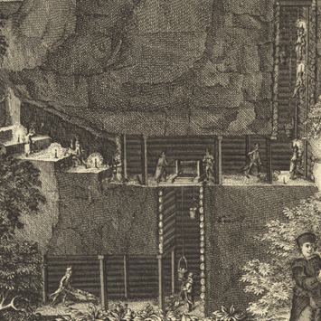
Schenk’s map of Erzgebirge (Ore Mountains), situated on the border of Saxony and Bohemia, offers a graphic tribute to a region whose economic livelihood relied on the extraction of tin, silver, cobalt, lead, and other metals. The map itself is based on surveys by Adam Friedrich Zürner, and the detailed depiction of mining activities in the lower right corner of the sheet is adapted from illustrations in Bericht vom Bergwerck by Georg Engelhard Löhneyss. The instruments at the top of the sheet provide reassurance about the accuracy of the cartographic content.