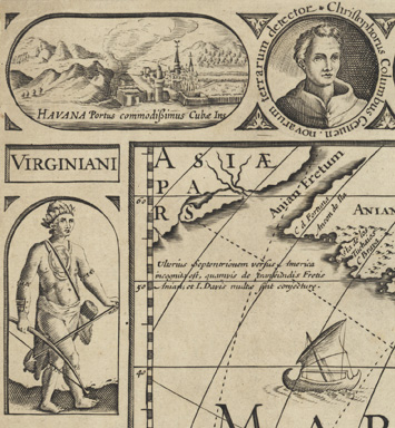
Visscher 1652

Americae nova descriptio. [Amsterdam?] ; 1652. Christophe Daniel Ebeling Collection, no. 4342. Gift of Israel Thorndike, 1818. |
Published by Visscher in 1652, Americae nova descriptio is the sixth state of Pieter van der Keere’s 1614 map of the same title. It was closely modeled on Willem Blaeu’s wall map of 1608, America quarta pars orbis, which included many of the same city views and images of native peoples. In both cases, the views and figures are primarily drawn from Theodore de Bry’s illustrations in his collections of travel accounts. De Bry himself never set foot in the Americas, but he had access to numerous accounts by European travelers and explorers, including those acknowledged on the borders of the map: Christopher Columbus, Amerigo Vespucci, and four circumnavigators (Ferdinand Magellan, Francis Drake, Thomas Cavendish, and Olivier van Noort).