Visscher 1675
Marchionatus Sacri Romani Imperii : Nobilißimo, Amplißimo, Prudentißimoq[ue] Senatuj Urbis Antverpiæ, nec non Marchionatus Sacri Imperij, Viris Consultissimis Sapientissimisq[ue]. [Amsterdam] : Nicolaus Jansenius Piscator, [ca. 1675]. Christophe Daniel Ebeling Collection, no. 2371.Gift of Israel Thorndike, 1818. |
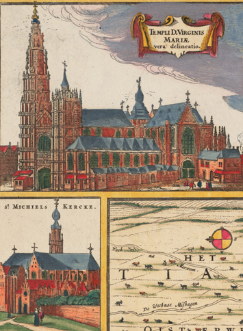
Visscher’s map of Antwerp is so rich in ornament that the plan of the city and its environs seems almost ancillary. By this time in the history of publishing, those charged with the task of embellishing maps had little difficulty in finding suitable material in the ample stock of imagery depicting major European cities. Besides the views of Antwerp from three vantage points, this map includes ten panels of architectural landmarks in Antwerp. For the four major buildings anchoring the sheet (the Cathedral of Our Lady, the Exchange, Town Hall, and Hanseatic League Headquarters), Visscher reproduced images culled from Ludovico Guicciardini’s Descrittione di tutti I Paesi Bassi (first published in 1567).