
A colorful woodcut map of Kanazawa from a birds-eye-view, circa 1850.
View Details.
Harvard Map Collection
Thousands of maps an atlases covering all parts of the world have been scanned and are now available online. Places that are well represented include:
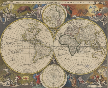
A double hemisphere map of the world from 1690 with brightly colored astrological figures in the corners.
View Details.
Harvard Map Collection
And themes that are highlighted include:
- Urban areas
- Navigational Atlases
- American Civil War
- Colonial North America
- Fire Insurance Atlases
For scanned maps, you can also consult the wonderful digitized collections at other institutions:
Accessing These Materials
This collection is available online.
You can also search HOLLIS for the title "Harvard Map Collection Digital Maps" for a listing of many (but not all) the different places that are covered.
Many of our scanned maps are available through Old Maps Online. You can also find georeferenced maps in the Harvard Geospatial Library.
Contact
David Weimer