How to Get Help
The Harvard Map Collection offers Harvard affiliates support with geographic information systems (GIS) methods, software, and data.
Example Mapping Projects
These are just a few ways we've supported faculty and students in using geospatial data to investigate nature, human societies, and historical change.
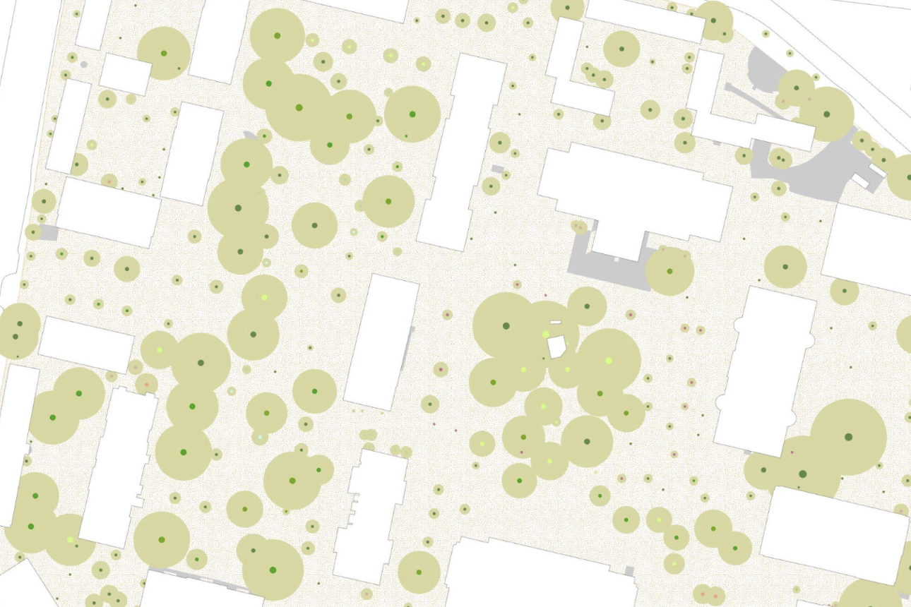
Using GIS to Understand Microhabitats
How GIS became embedded into a history course about "re-wilding" urban spaces.
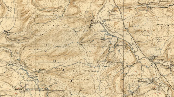
Digitizing Trench Maps from World War I
Turning historical WWI trench lines on a map into geospatial data.
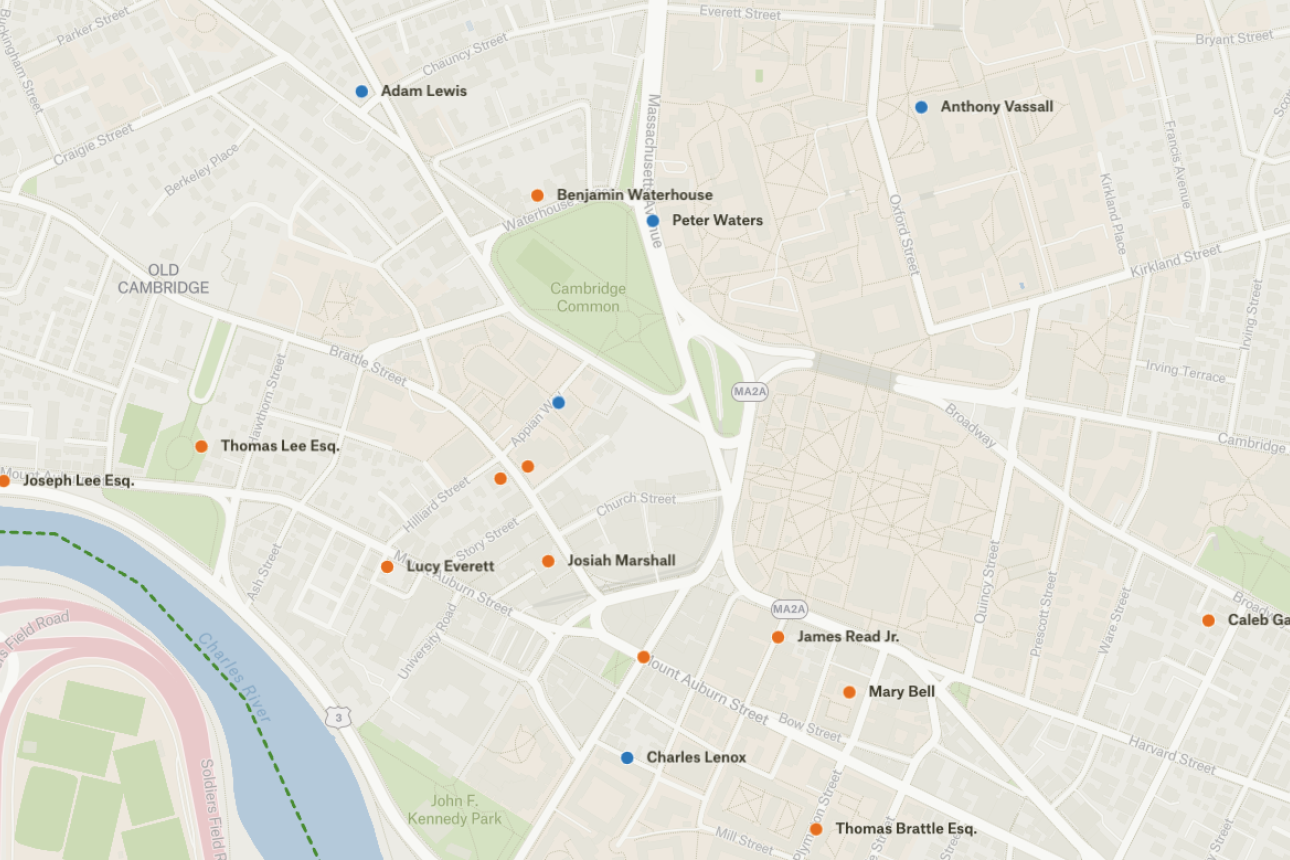
Mapping Black Cambridge
Using data to to discern historic dimensions of Black life in Cambridge.